| Map |
| of Satterthwaite Parish |
| This three-dimensional map shows the Parish viewed at an angle of 55º, with the sun in the east. |
| |
| Click on the map to enlarge, then use scroll bars to navigate. Place names underlined in red are interactive. |
| |
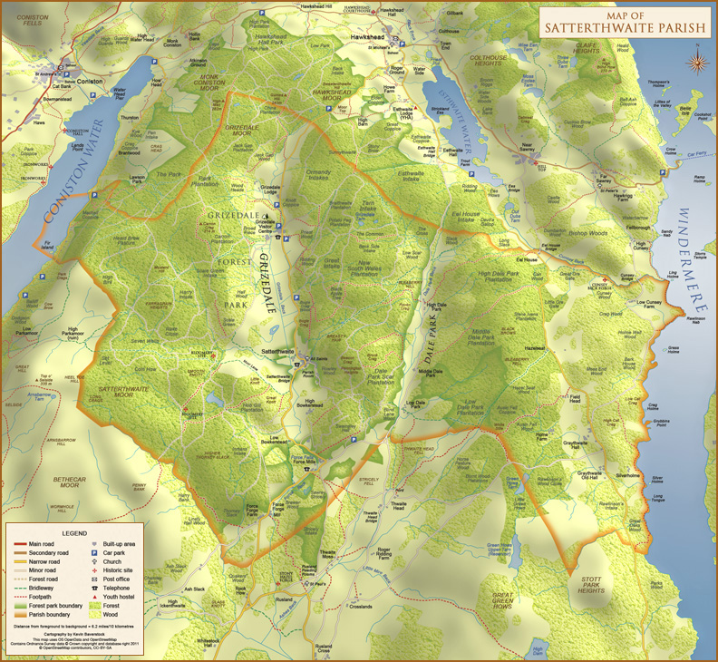 |
| Contains Ordnance Survey data © Crown copyright and database right 2011. | Open Street Map © OpenStreetMap contributors, CC-BY-SA |
|